For me? I just go look a bit at the actual data. It would seem a reasonable thing to do.

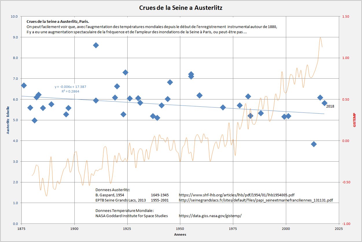
On peut facilement voir que, avec l'augmentation des temp�ratures mondiales depuis le d�but de l'enregistrement instrumental autour de 1880, il y a eu une augmentation spectaculaire de la fr�quence et de l'ampleur des inondations de la Seine � Paris, ou peut-�tre pas ...
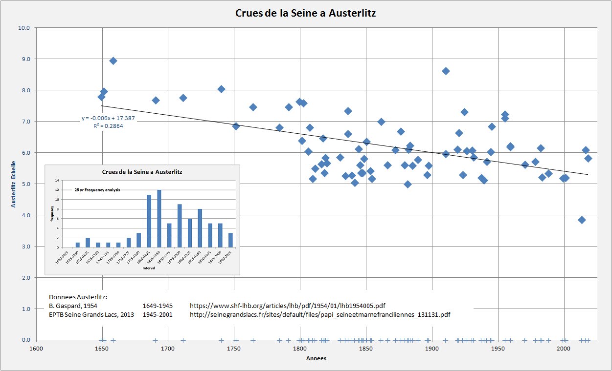
Donnees Austerlitz:
B. Gaspard, 1954		1649-1945	https://www.shf-lhb.org/articles/lhb/pdf/1954/01/lhb1954005.pdf
EPTB Seine Grands Lacs, 2013	1955-2001	http://seinegrandslacs.fr/sites/default/files/papi_seineetmarnefranciliennes_131131.pdf

Donnees Temp:
NASA Goddard Institute for Space Studies	https://data.giss.nasa.gov/gistemp/

A possible confounding factor in the above data, especially the frequency data, concerns the construction of navigation/flood control dams on the rivers flowing into the Seine. The following table shows the current situation:
Les barrages		mis en service	fleuve
Panneciere			1949	Yonne
Seine Morge			1966	Seine
Marne Giffaumont		1974	Marne
Radonvilliers/Brevonnes		1991	Aube
La Bassee			2020	Seine (pas en service)
Although these dams are as much for navigation as for flood control, they certainly do influence the frequency of floods, especially smaller floods, (less than 6m at Austerlitz). The floods of 2016 and 2018 were both characterized by having the reservoirs at about 95% capacity at the time of heavy rains. The dams thus quickly filled and the rivers then behaved essentially as if the dams were not present. Filling the dams early is normal management as the water is needed later in the summer/fall to maintain the water level in the Seine for navigation.